![](/images/other/stat-length.png)
![Tocht Te voet okres Malacky - Náučný chodník Malé Leváre - Photo](https://media.geolcdn.com/t/1900/400/32152349-28d2-4513-a8b2-9277d5cf8fb6.jpeg&format=pjpeg&maxdim=2)
Náučný chodník Malé Leváre
SityTrail - itinéraires balisés pédestres
Tous les sentiers balisés d’Europe GUIDE+
![Lengte](/images/other/stat-length.png)
Lengte
11,5 km
![Max. hoogte](https://static1.geolcdn.com/siteimages/upload/files/1508320355ic_sort_altitude_max_24dp.png)
Max. hoogte
162 m
![Positief hoogteverschil](https://static1.geolcdn.com/siteimages/upload/files/1508320355ic_sort_den_pos_24dp.png)
Positief hoogteverschil
84 m
![Km-Effort](/images/other/stat-length.png)
Km-Effort
12,6 km
![Min. hoogte](https://static1.geolcdn.com/siteimages/upload/files/1508320355ic_sort_altitude_min_24dp.png)
Min. hoogte
143 m
![Negatief hoogteverschil](https://static1.geolcdn.com/siteimages/upload/files/1508320355ic_sort_den_neg_24dp.png)
Negatief hoogteverschil
83 m
![Boucle](https://static1.geolcdn.com/siteimages/upload/files/16400158638029165_repeat_loop_refresh_sync_direction_icon.png)
Boucle
Ja
Markering
Datum van aanmaak :
2025-02-06 15:06:01.884
Laatste wijziging :
2025-02-06 15:06:01.884
![Te voet](https://static1.geolcdn.com/sitytour/trail-icons/100.png)
2h52
Moeilijkheid : Gemakkelijk
![Scan deze QR-code om de tocht te openen in de SityTrail-applicatie](https://capi.geolives.com/qq0zvz2zws4bq2lad0pu/sitytour/trails/4343329/qr.png?size=200)
Gratisgps-wandelapplicatie
Over ons
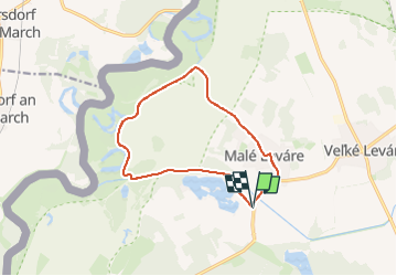
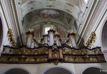
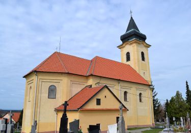
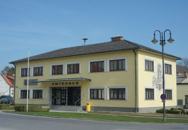
Tocht Te voet van 11,5 km beschikbaar op Bratislavský kraj, Onbekend, okres Malacky. Deze tocht wordt voorgesteld door SityTrail - itinéraires balisés pédestres.
Beschrijving
Symbool: education
Website: http://naucnechodniky.eu/naucny-chodnik-male-levare/
Plaatsbepaling
Land:
Slovakia
Regio :
Bratislavský kraj
Departement/Provincie :
Onbekend
Gemeente :
okres Malacky
Locatie:
Malé Leváre
Vertrek:(Dec)
Vertrek:(UTM)
645348 ; 5372789 (33U) N.
Opmerkingen
Wandeltochten in de omgeving
![Tocht Te voet okres Malacky - Hasprunská 50 - Photo](https://media.geolcdn.com/t/375/260/3a99c7b0-3a4c-4219-9389-170de740cc61.jpeg&format=jpg&maxdim=2)
![Te voet Te voet](https://static1.geolcdn.com/sitytour/trail-icons/100.png)
Hasprunská 50
Te voet
Zeer moeilijk
okres Malacky,
Bratislavský kraj,
Onbekend,
Slovakia
![](/images/other/stat-length.png)
39 km | 44 km-effort
10h 3min
![](https://static1.geolcdn.com/siteimages/upload/files/16400158638029165_repeat_loop_refresh_sync_direction_icon.png)
Ja
![Tocht Te voet okres Pezinok - Lesnícky náučný chodník Pece - Čertov kopec - Photo](https://media.geolcdn.com/t/375/260/f371d2e7-47c7-4a98-92af-3d410f42d94c.jpeg&format=jpg&maxdim=2)
![Te voet Te voet](https://static1.geolcdn.com/sitytour/trail-icons/100.png)
Lesnícky náučný chodník Pece - Čertov kopec
Te voet
Gemakkelijk
okres Pezinok,
Bratislavský kraj,
Onbekend,
Slovakia
![](/images/other/stat-length.png)
4,4 km | 7 km-effort
1h 35min
![](https://static1.geolcdn.com/siteimages/upload/files/16400158638029165_repeat_loop_refresh_sync_direction_icon.png)
Neen
![Tocht Te voet okres Senica - Náučný chodník Gazárka – Lásek - Photo](https://media.geolcdn.com/t/375/260/70155dd2-90cf-4fc6-bb5f-9c3c33e66fe8.jpeg&format=jpg&maxdim=2)
![Te voet Te voet](https://static1.geolcdn.com/sitytour/trail-icons/100.png)
Náučný chodník Gazárka – Lásek
Te voet
Gemakkelijk
okres Senica,
Trnavský kraj,
Onbekend,
Slovakia
![](/images/other/stat-length.png)
5,1 km | 5,6 km-effort
1h 16min
![](https://static1.geolcdn.com/siteimages/upload/files/16400158638029165_repeat_loop_refresh_sync_direction_icon.png)
Neen
![Tocht Te voet okres Senica - Náučný chodník Lakšárska Nová Ves – Tomky - Photo](https://media.geolcdn.com/t/375/260/d27d81a8-8338-4c96-a68b-62a7fe31fde0.jpeg&format=jpg&maxdim=2)
![Te voet Te voet](https://static1.geolcdn.com/sitytour/trail-icons/100.png)
Náučný chodník Lakšárska Nová Ves – Tomky
Te voet
Gemakkelijk
okres Senica,
Trnavský kraj,
Onbekend,
Slovakia
![](/images/other/stat-length.png)
10,4 km | 11,7 km-effort
2h 40min
![](https://static1.geolcdn.com/siteimages/upload/files/16400158638029165_repeat_loop_refresh_sync_direction_icon.png)
Neen
![Tocht Te voet Gemeinde Prottes - Erdöl- und Erdgaslehrpfad Prottes - Photo](https://media.geolcdn.com/t/375/260/ebc6b98f-8c30-451b-a83c-b05e882a3ad9.jpeg&format=jpg&maxdim=2)
![Te voet Te voet](https://static1.geolcdn.com/sitytour/trail-icons/100.png)
Erdöl- und Erdgaslehrpfad Prottes
Te voet
Gemakkelijk
Gemeinde Prottes,
Neder-Oostenrijk,
Bezirk Gänserndorf,
Austria
![](/images/other/stat-length.png)
3,7 km | 4,5 km-effort
1h 1min
![](https://static1.geolcdn.com/siteimages/upload/files/16400158638029165_repeat_loop_refresh_sync_direction_icon.png)
Neen